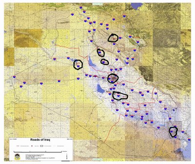
The main coalition bases and roads

The ethnic dispersion in Iraq
If you look at the two maps, you see that the US can only move the bulk of their forces south, through the Shia heartland.
This is critical in understanding how ugly this fight could be.
The fact is that the Iraqi government could come apart by the weekend, actually mid day Wednesday, if the Sadrists leave the government. Maliki could be in Jordan and the Green Zone could have new owners.
Bush is now officially over his head and is unlikely to be president by this time next year if a forced retreat from Iraq is the result. Nixon was long gone by the end of the Vietnam War.
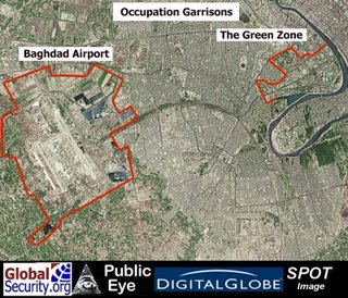
So let's go over the topography, starting in Baghdad.

See the green zone and the airport?
Notice the highway between them, the most dangerous highway in the world?

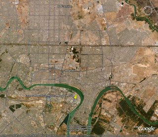
Looking at the area of the Green Zone east. Well, that's the infamous Sadr City. It goes on for a while and has half of Baghdad's population.
Leaving Baghdad will be hard, if not impossible, for all but US citizens. Iraqi collaborators will be at the mercy of Shia and Sunni mobs and their deaths will be gruesome.
Getting out of Baghdad by ground is almost impossible to imagine.
But that would be the easy part. It is 300 miles to the Kuwaiti border, with several chokepoints along the way.

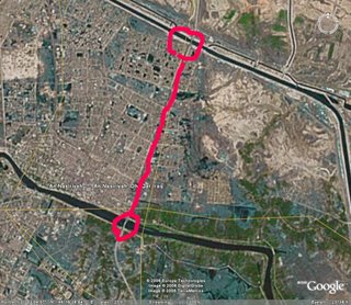
This is Nasyriah. This is where the 509th Maintenance Company convoy broke down and the
US Marines fought an intense battle to control both bridges. But that was in an advance. The US would have to hold both ends for as long as the convoys needed to cross it. Which means they would have to seize it at the start of any retreat. Any delay would lead to the bridges being blown.
It isn't just money which makes Sadr powerful, it's geography.
No comments:
Post a Comment